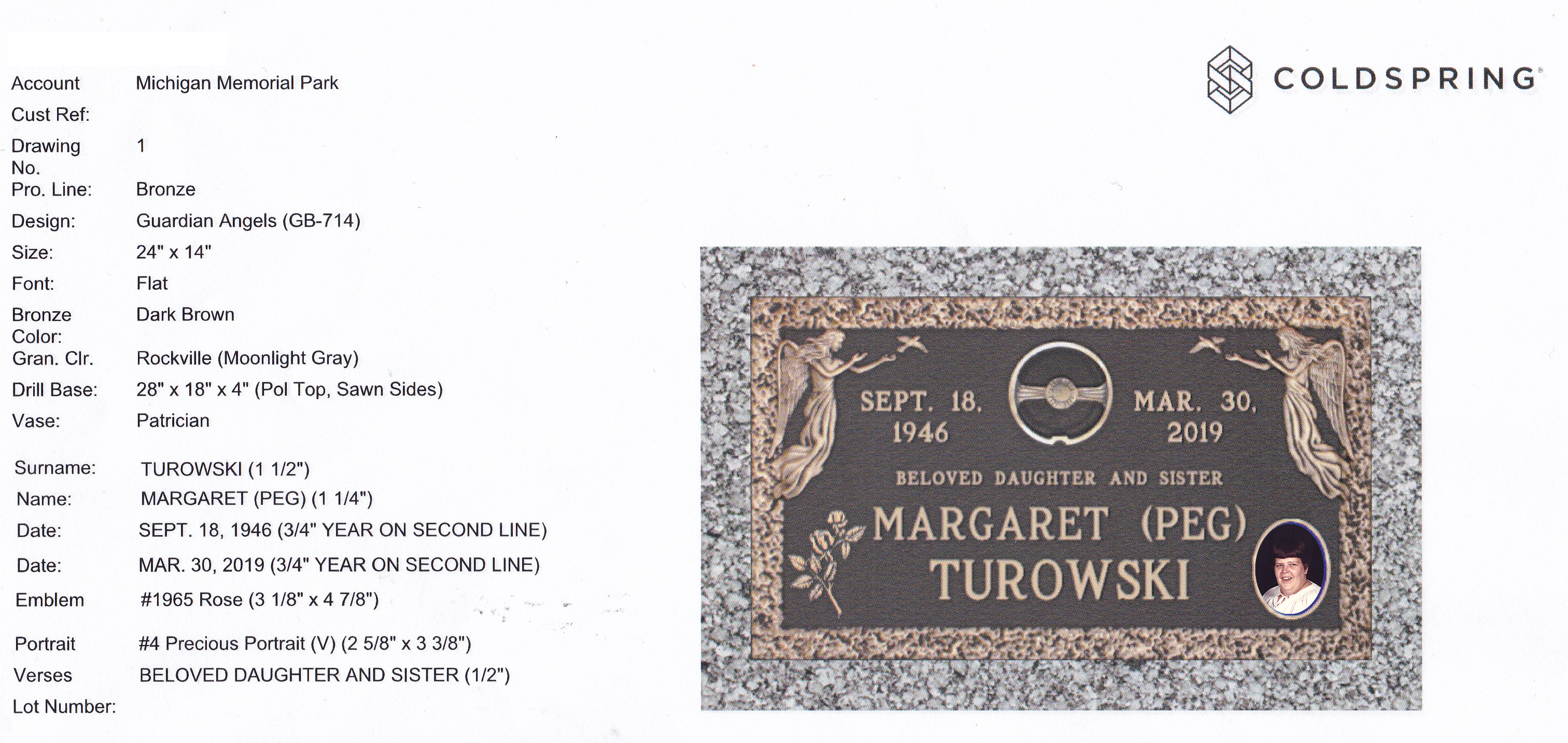
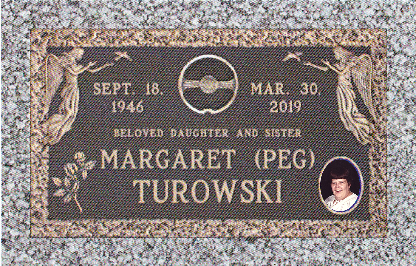
 Today we took a day off from work and went to Michigan Memorial to finalize Pegs grave marker. Shown on the left is a preview of what to expect, it should be finished in 8 weeks and we are hoping everyone can get together around labor day for a little reunion.
People may have noticed that part of the wall near where Peg was buried is being removed, this is to make room for a stations of the cross monument where all the stations will be honored. It should be completed in 5 years so there will still be a landmark to find these graves for us.
We did travel to the 3 grave sites that we are most familiar with and had Michigan Memorial create maps on how to get to these areas. Each is identified by a block number which makes it easy to find the location on the main map (included with each block pdf). two secondary maps are also included in the pdf which show the exact location of the graves in the block. Please note if you see green in the one map that means that plots are available to buy. We will do these in order.
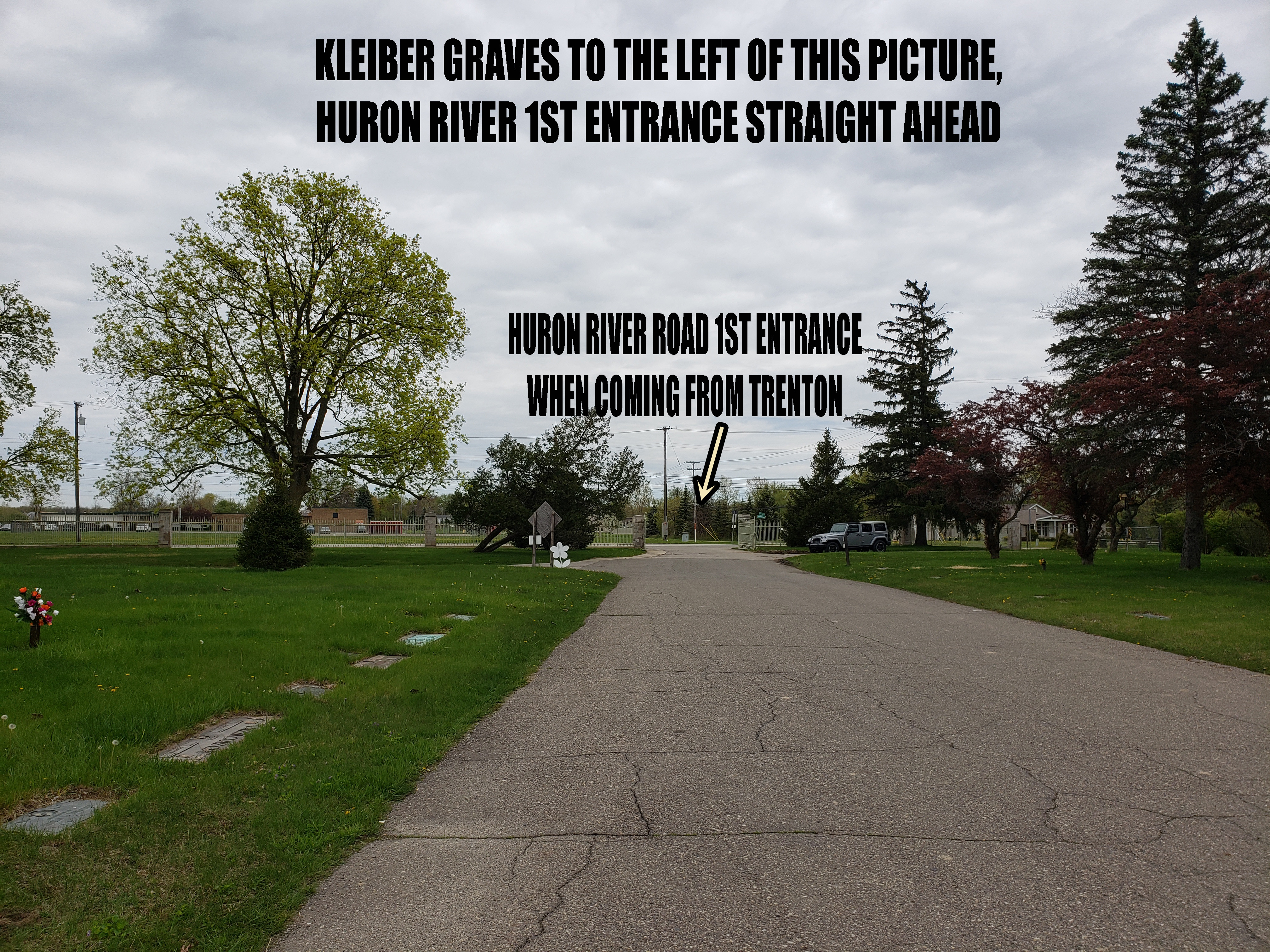
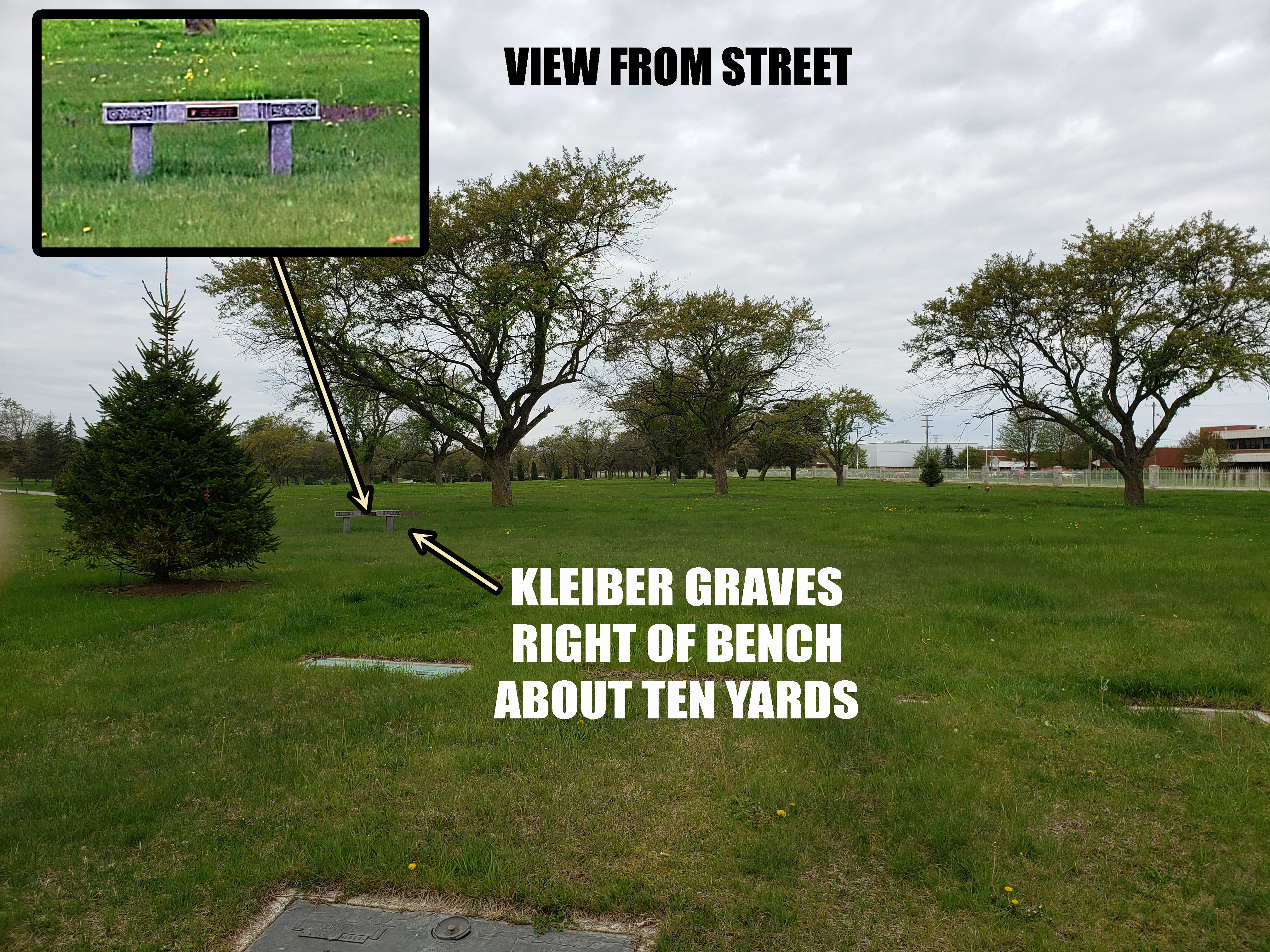
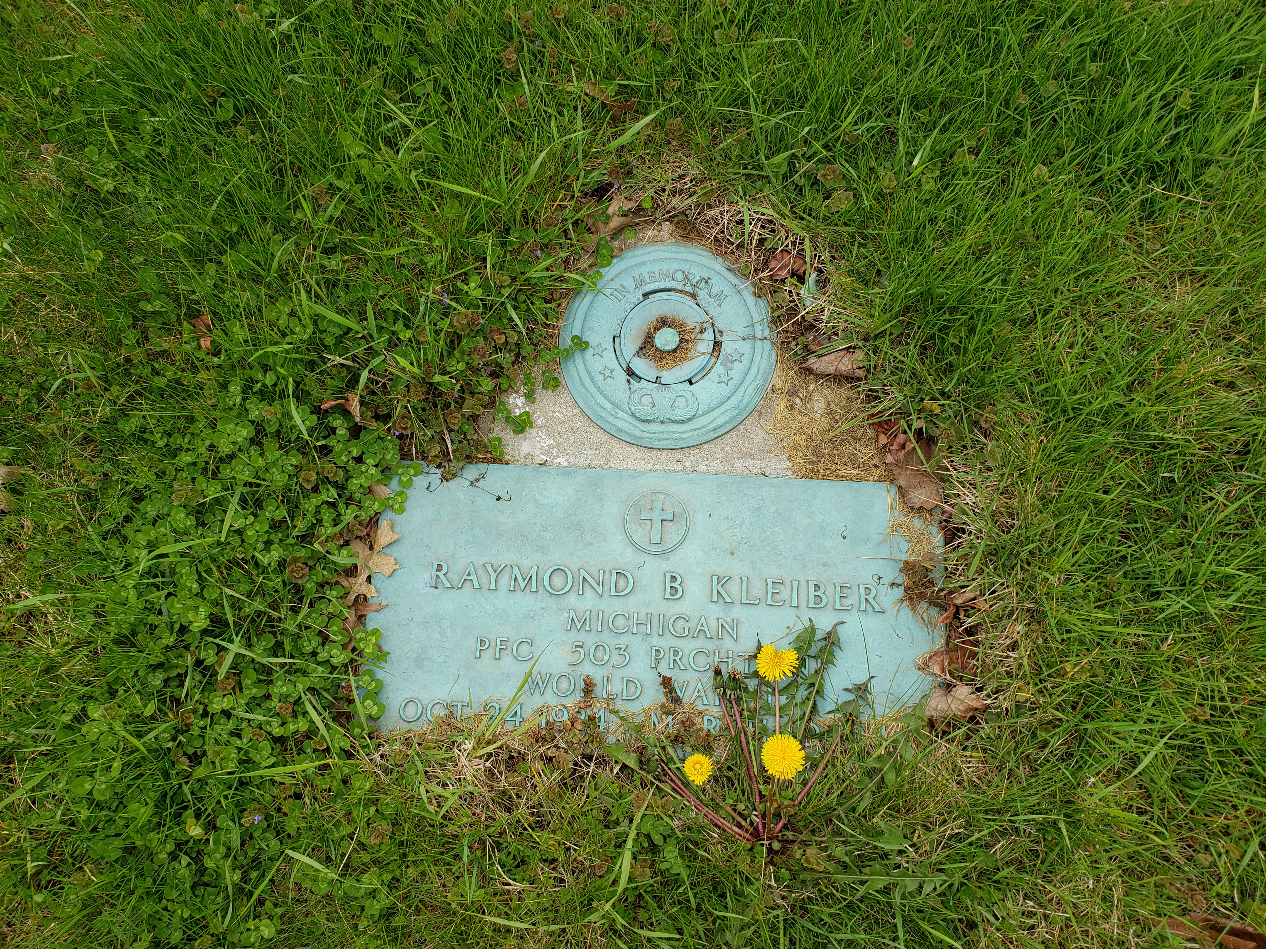
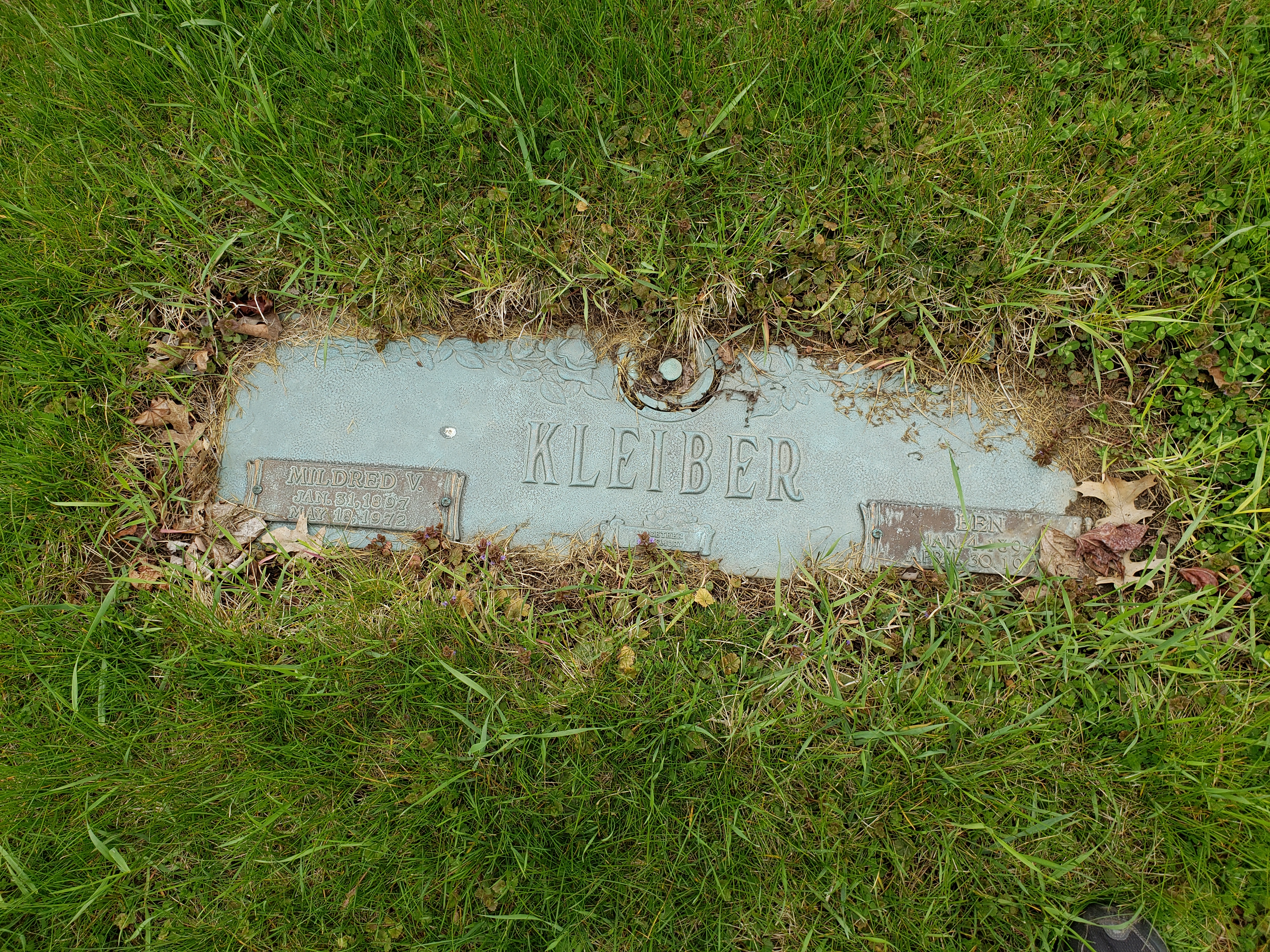
Block 6 We Call The Kleiber Plots – This has James Great Grandma Kleiber, James Great Grandma Kleiber, and James Great Uncle Raymond Kleiber who died in WW2 and was the first in the family buried at Michigan Memorial Cemetery. This is located near the first entrance to the cemetery from Huron River Drive, not the main entrance. When you come in through the entrance look for a bench on the right, the graves are about ten yards to the right (north) of that bench. You can find maps to block 6 in the link below –
also there are pictures in the gallery below to help.
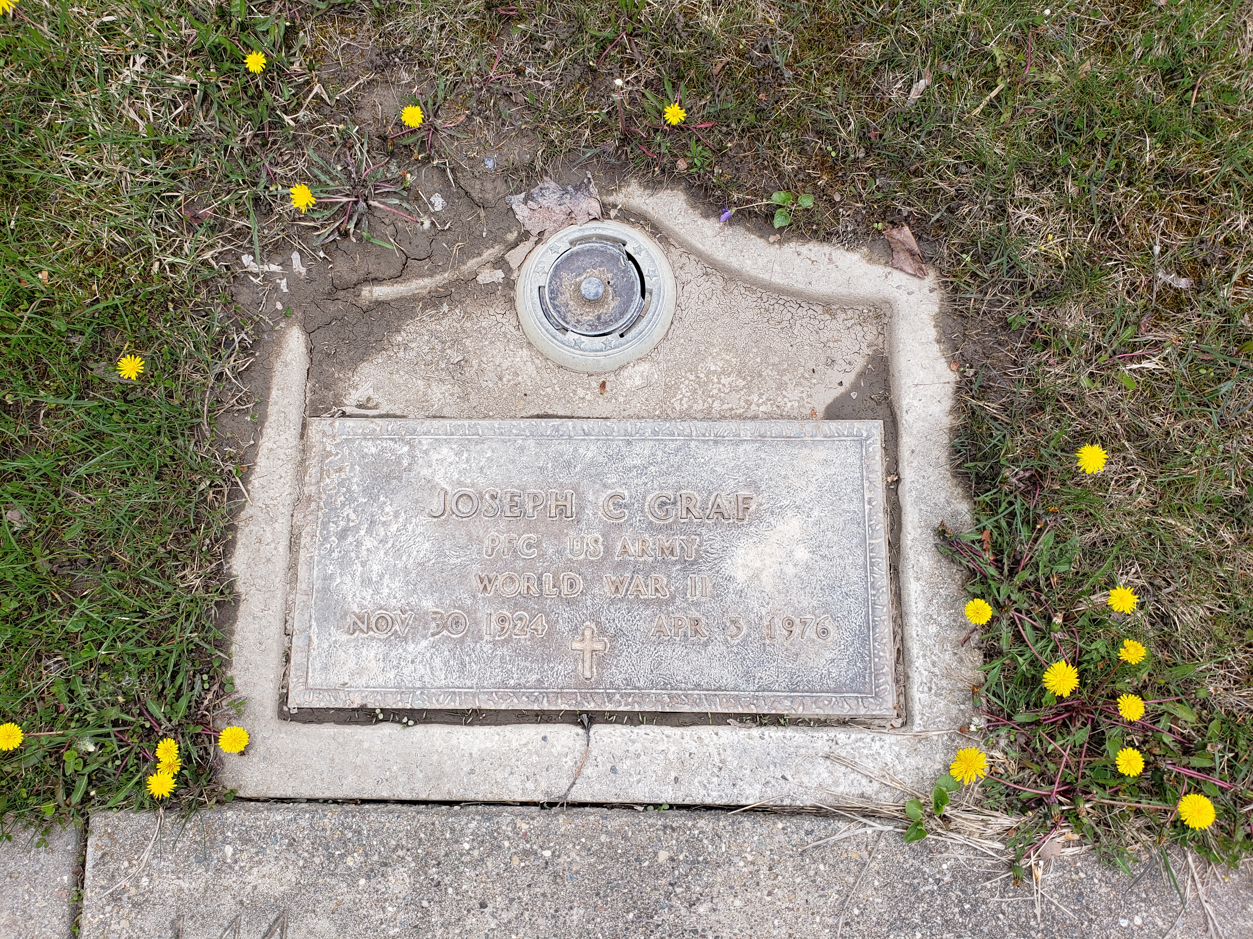
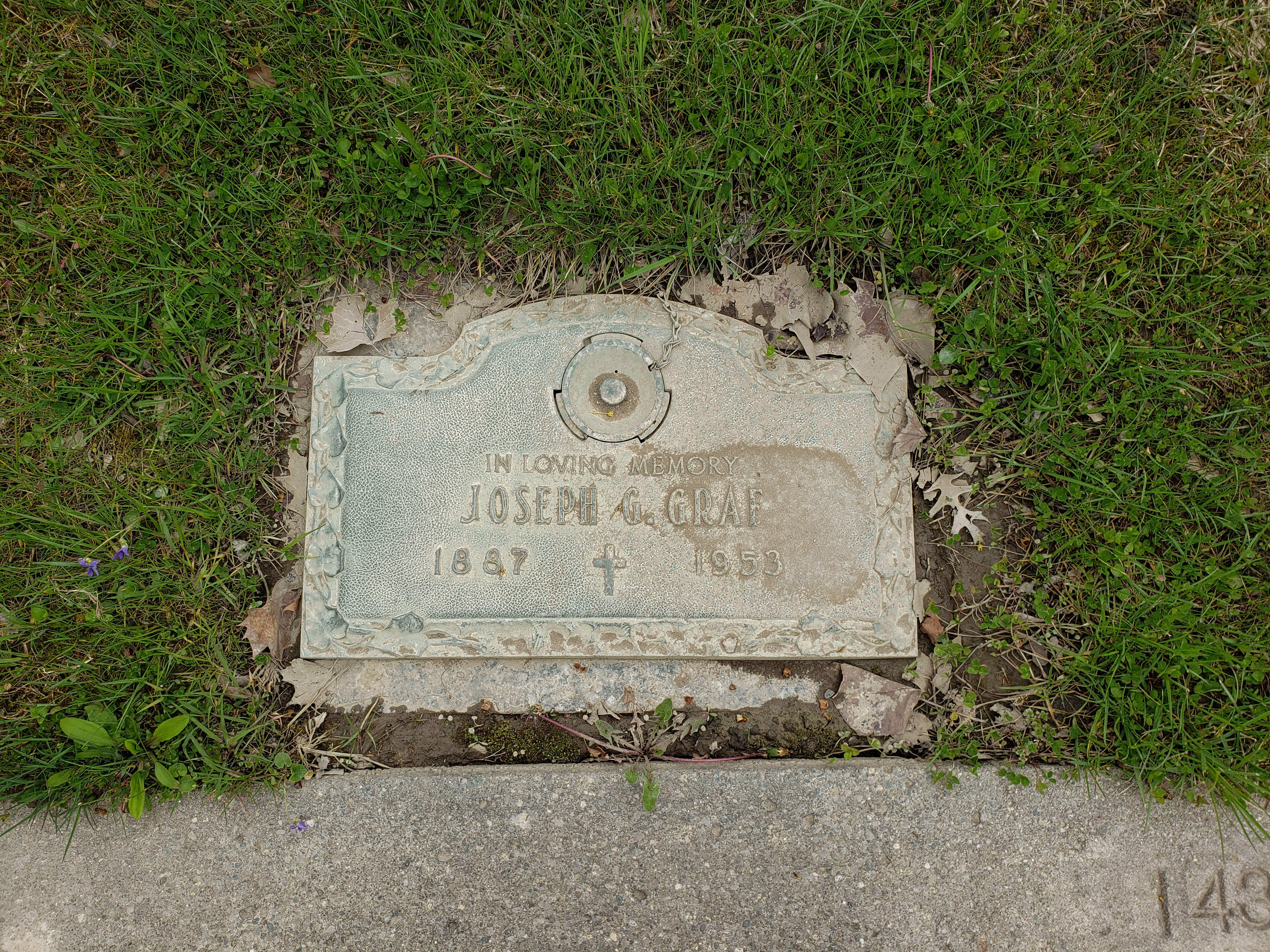
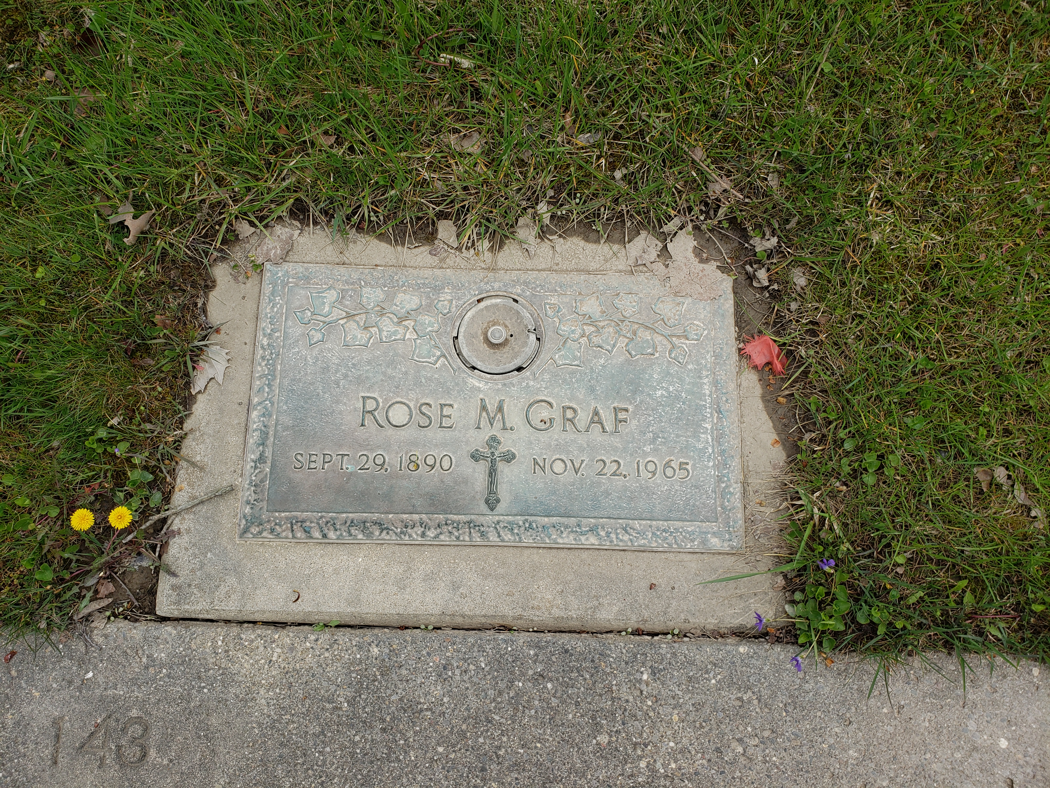
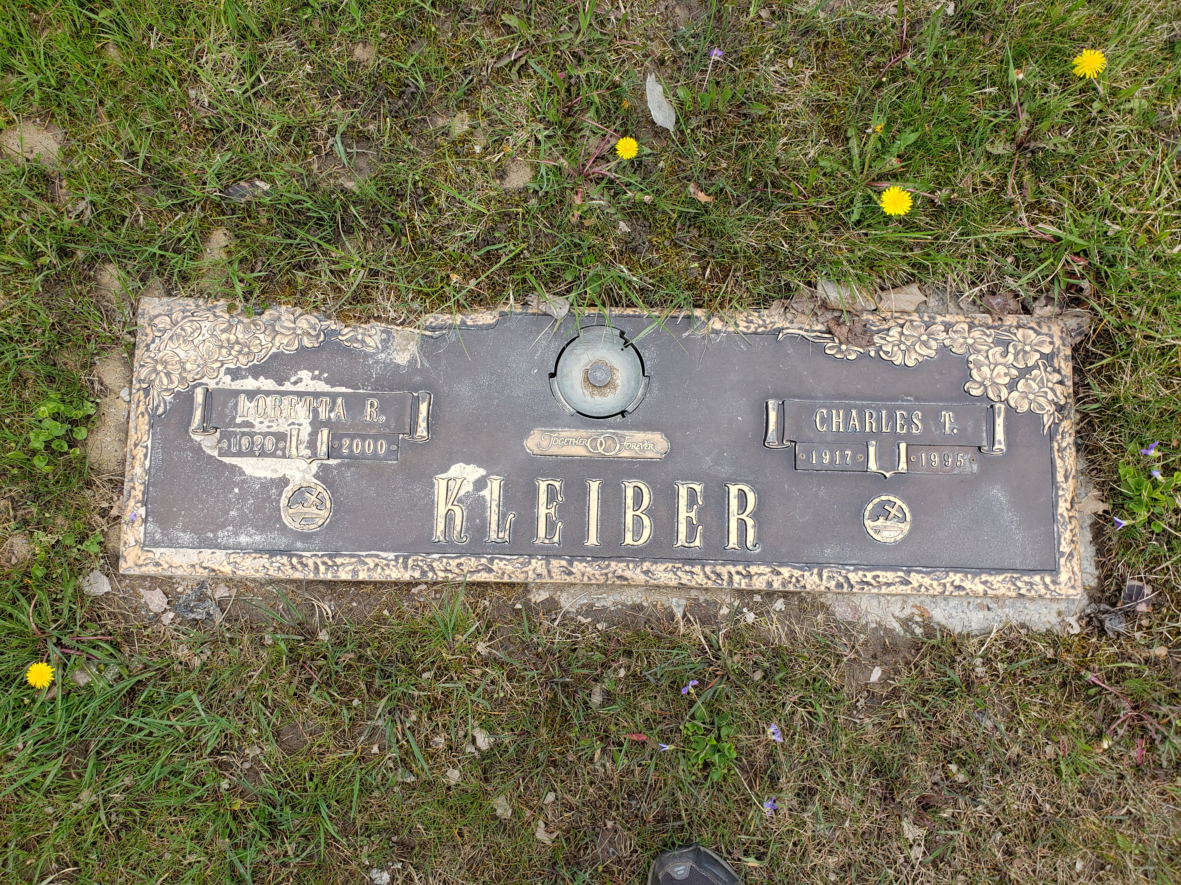
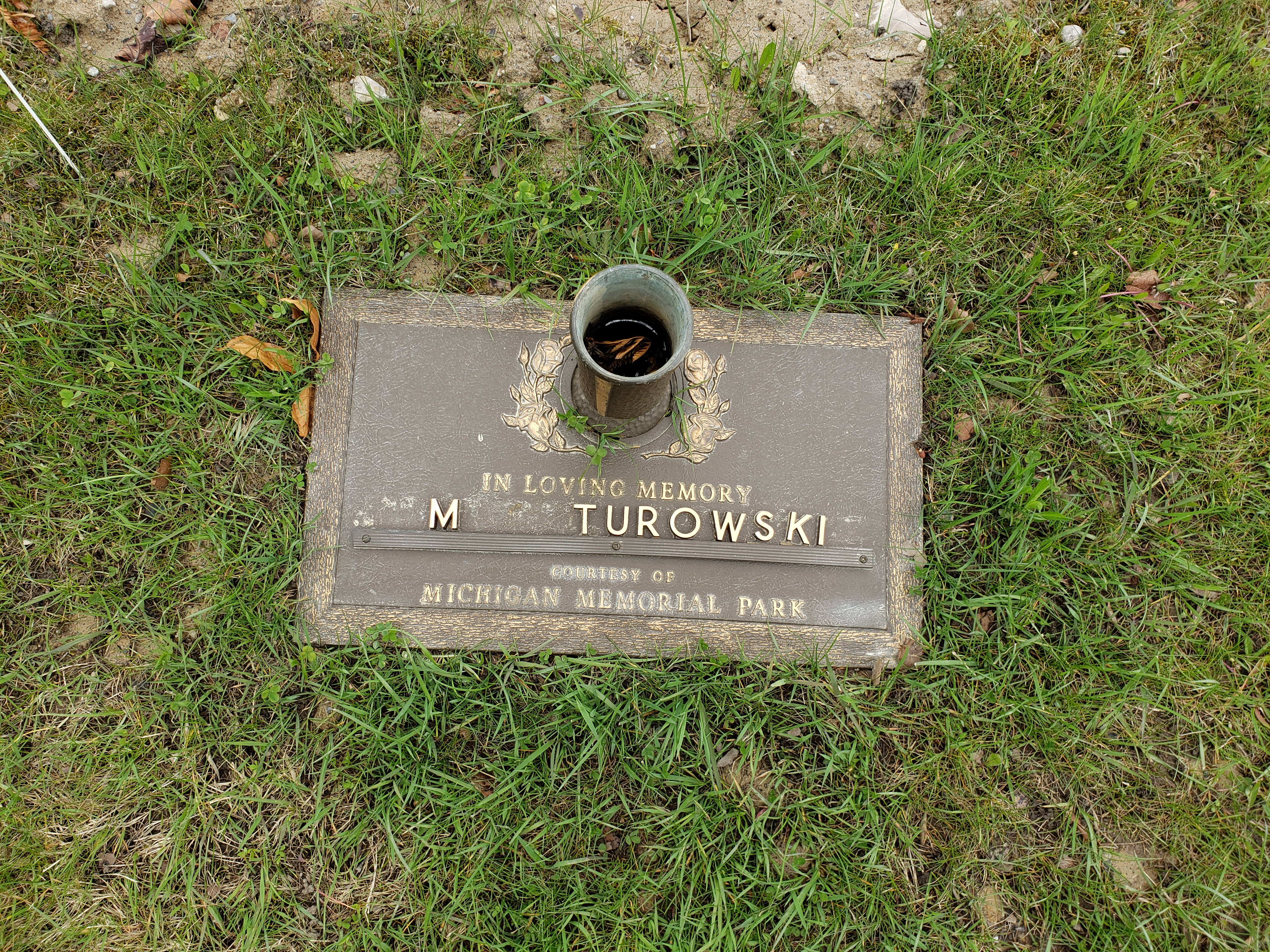
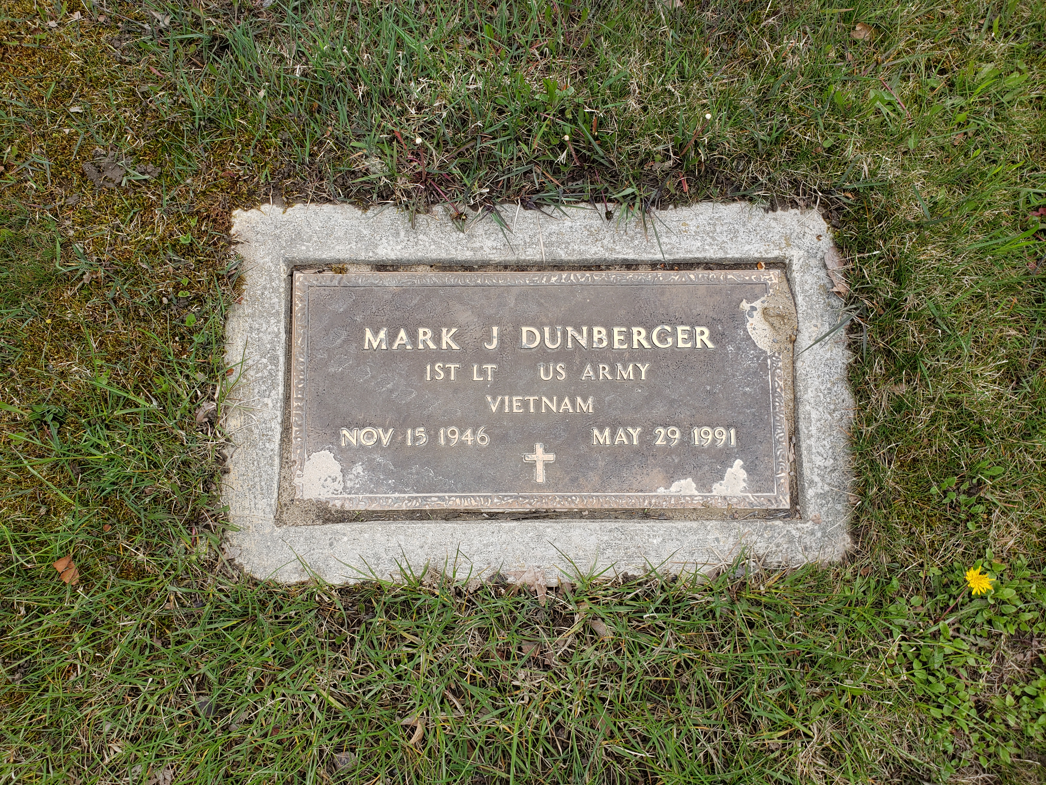
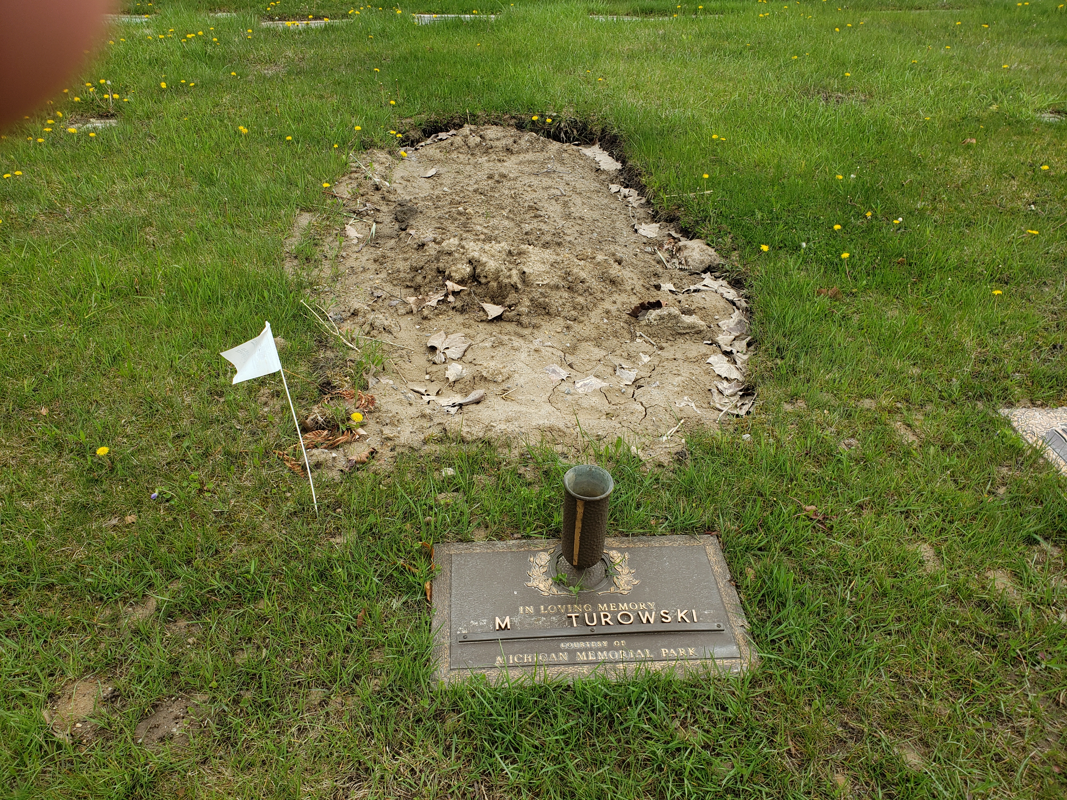
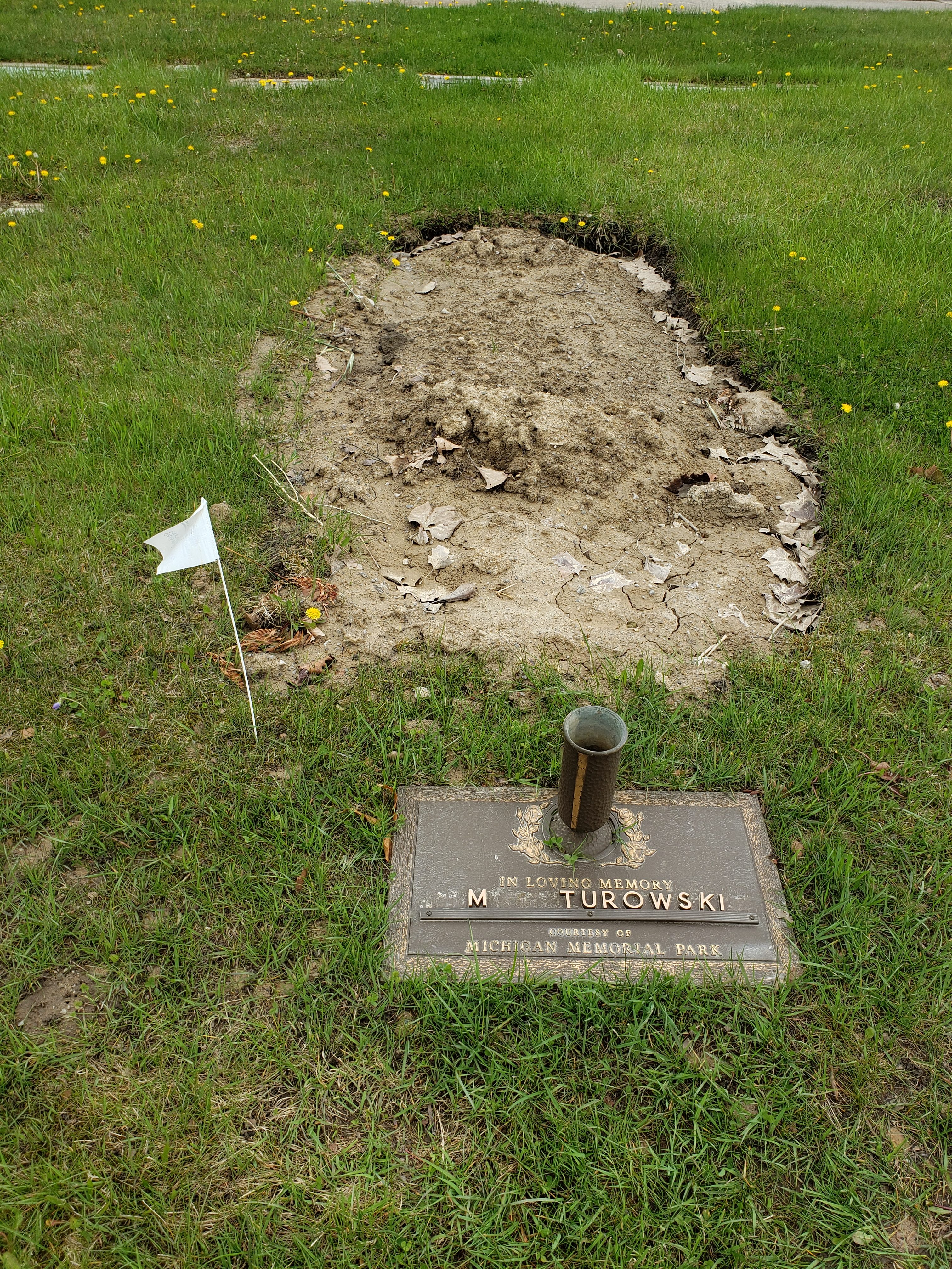
Block 24 We Call The Graf Plots – This is the largest block of relatives with 12 plots owned by the family and 9 currently used. James Grandma and Grandpa Kleiber, Great Uncle Joe, Great Aunt Louise and her Husband Harry, Great Grandmother Graf, Great Grandfather Graf, Cousin Mark, and most recently Aunt Peg. To find this simply stay right when you enter the main entrance until you see the long brick wall (or crucifix island). FYI, the wall is being turned into a Stations of the Cross monument and should be complete in 5 years. You can find maps to block 24 in the link below –
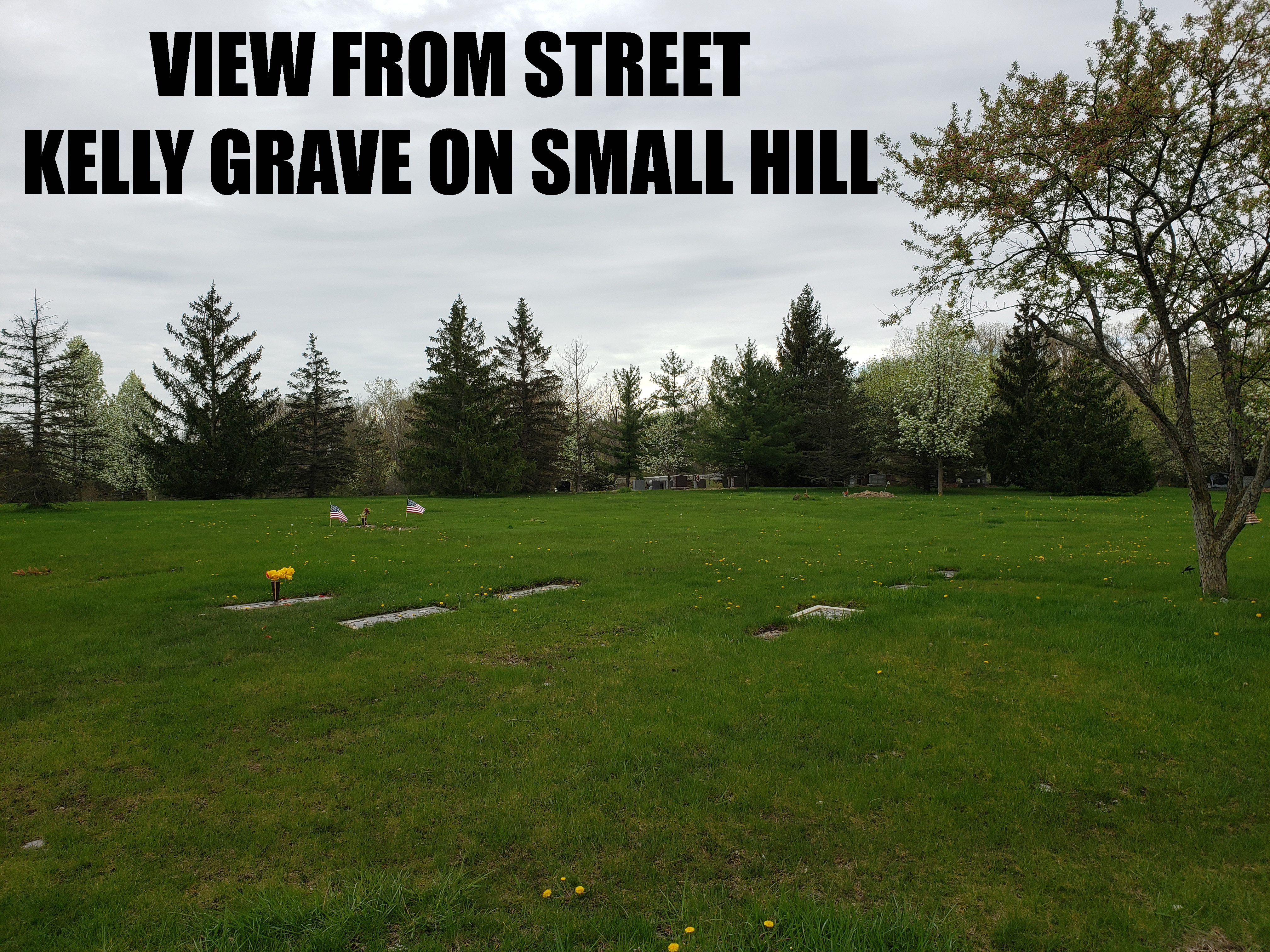
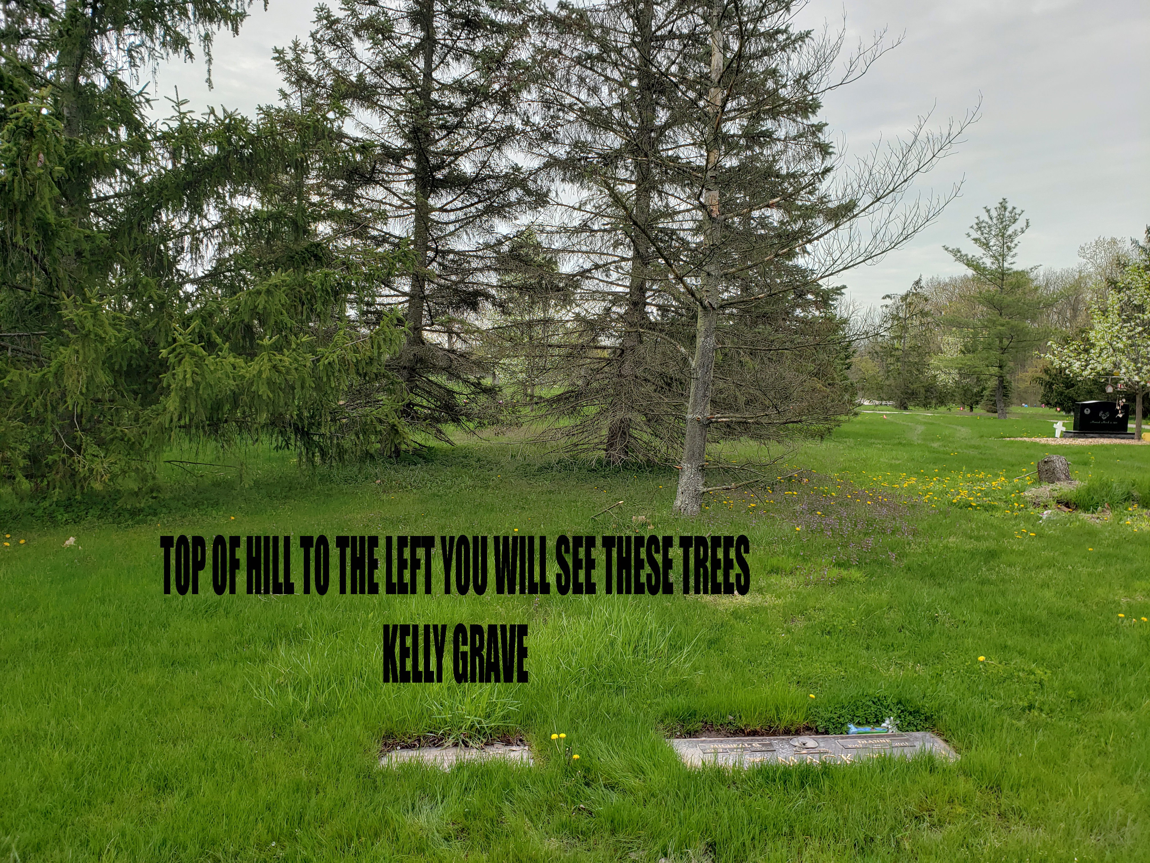
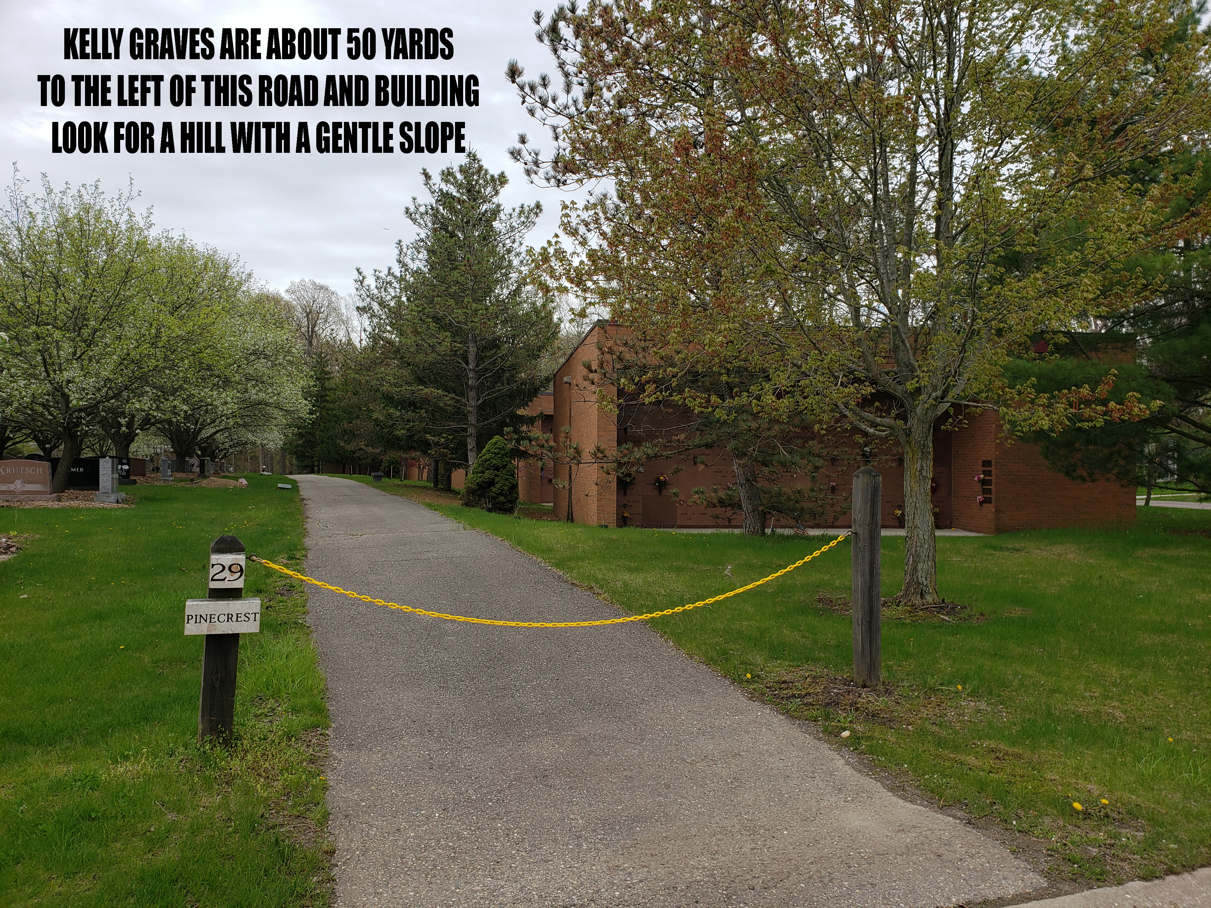
Block 29 We Call The Kelly Plot – This is where Natalies husband and child lay in rest. If you are going there from “the wall” veer to the left at the fork and go straight till you see a hill on the right. A landmark is a small building with a street next to it which can be seen in the gallery below. You can find maps to block 29 in the link below –
This Kelly grave was the hardest of the three to find for us so I used my phone to get gps coordinates for the grave, they are below. (we will try it out for accuracy next visit which should be Moms Day, weather permitting)
Latitude (LAT): 42.117504
N 42°7’3.01368″
Longitude (LONG): -83.349019
W 83°20’56.46804″
also there are pictures in the gallery below to help.